Digital Terrain / Surface Models (DTM / DSM)

Three-dimensional digital terrain / surface models (known also under abbreviation DTM / DSM) are a result of space mapping of an area. Digital surface models are used especially for 3D modeling of towns and landscape, as a basis for demonstrative visualizations and in various GIS applications. A survey is usually performed using aerial survey photography or laser scanning. It is possible to use classic geodetic methods or GNSS as well.
Digital terrain / surface models can vary in number of captured details, there are also differences in the way of landscape rendering. It is necessary to draw the line between digital terrain model (DTM) and digital surface model (DSM).
Digital Terrain Model (DTM)
 Digital terrain model is focused only on the shape of topographic areas. Model generation is based on the surveyed surface data, all other superfluous elements not related with the shape of georelief (e.g. buildings, vegetation…) are filtered out. Digital terrain models are useful especially in hydrological, geological and archaeological applications in GIS.
Digital Surface Models (DSM)
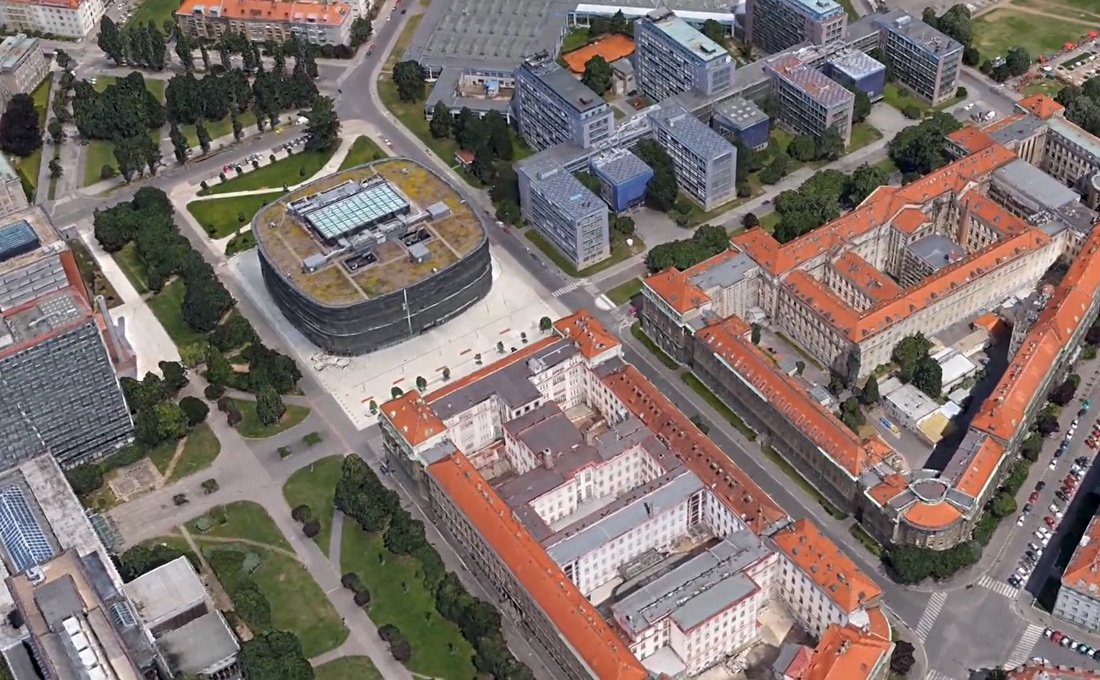 Digital surface model represents a true copy of an area. Its georelief contains all natural and artificial elements that are related to concerned area (trees, vegetation, buildings and other objects…).
Digital surface models are primarily used in 3D modeling of towns and landscape or for visibility analysis in GIS. Various visualizations may be generated from the model.
Structure of Digital Terrain / Surface Model
Most commonly digital terrain / surface model is constituted from triangular mesh generated among directly surveyed or photogrammetrically identified points. Digital terrain / surface model may be rendered as a wire model, single-colour areas or areas filled with photorealistic texture. If the last option is used, we get an almost perfect digital copy of the real world.
It is possible to transform digital terrain / surface models via identical (ground control) points to any coordinate system according to customer’s preferences, including correction of measuring scale.

Landscape Survey Options
Laser scanning of landscape can be executed using ground laser scanning device that is very fast and accurate. The survey is usually performed in standard resolution of 5 × 5 mm. Aerial photogrammetric device is more suitable for surveying large areas. Level of detail of the output 3D model is determined by the flight altitude and by the resolution of photographs.