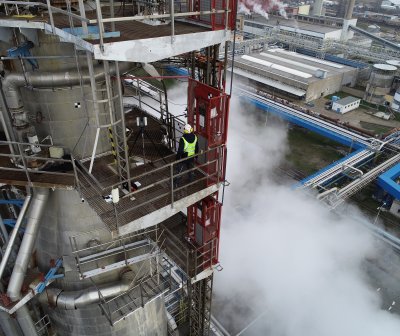
We have many years of experience in 3D laser scanning in industrial complexes all over the world. We scan in the chemical, engineering, energy and petrochemical industries. Thanks to this experience we are able to process large-scale projects with an emphasis on high data quality. We provide our clients with first class data in a short time. The efficiency of our technicians and our company's hardware reduce time in the field and minimize disruption to operations on job sites and in high-risk areas. With our 3D laser scanners, we survey complicated parts of technology even in inaccessible places.
Precise basis for your projects
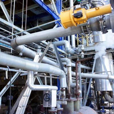
- laser scanning is the first step towards 3D models of technological units - piping systems, production lines and other technological equipment
- basis for project documentation in 3D/2D and building information models (BIM)
- as-built documentation
- deformation analysis, collision detection
- difference models, possibility of recording changes over time with repeated scanning
- site plans and GIS
- safety studies
- possibility of combination with thermal imaging (heat leakage monitoring)
Non-destructive and non-contact measurement down to the last detail
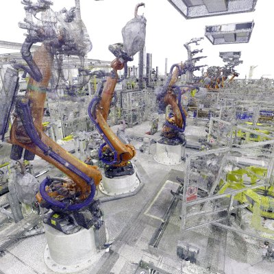
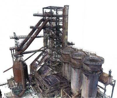
3D laser scanning is an accurate, fast and safe method of measuring the true state of large-scale technological units and objects such as production lines, piping systems, processing technologies and other industrial equipment. After converting the point cloud into a 3D model, you get a digital twin of your technology.
G4D provides you with a reliable and accurate representation of the actual condition. 3D laser scanning will reduce your costs when designing changes to existing technologies, designing new technologies, collision avoidance, change detection and deformation analysis.
Millions of points measured per second
- comprehensive as-built survey of the actual situation on site
- high data acquisition speed (millions of points per second)
- millimetre accuracy
- non-selective data acquisition - focuses all details at the selected resolution
- non-contact measurement - no need to stay in dangerous areas and touch scanned objects (machines, hot parts, etc.)
- non-destructive measurement safe for persons and objects to be measured
- scanning without interrupting production
- easy data sharing thanks to customised online solutions
- virtual reality browsing
- cheaper and faster implementation (everything is designed according to the as-built documentation, no need to return to the site)
Why point cloud?
A point cloud is the basic output of laser scanning. Points describe all surfaces of the measured objects, not just selected points as in conventional geodetic methods. They are defined by spatial coordinates (x, y, z) and optionally also by information about the colour and reflectivity of the material. The level of detail captured depends on the selected density/interval of points (e.g. 5 mm between points). Measurements, sections and various analyses can be performed in the point cloud. The advantage is the wide range of further processing options, for example, conversion into a vector BIM or CAD model for design work.
We supply point clouds optimized for 3D software such as Autodesk, Bentley, Catia, AVEVA, Solid Edge, Solidworks, Rhino and similar in standard software formats (.XYZ, .LAS, .E57 and others). For viewing and measuring point clouds, we supply offline or online viewers with panoramic view capability from the scanner position.