Quality projects need quality documentation that do not provide for ambiguity. Such data will save you a lot of worries and finance during the phases of the project. We are happy to prepare just such documentation, concerning the actual state of the building based on 3D laser scanning and photogrammetric capturing.
Why to 3D scan when you need a 2D drawing?
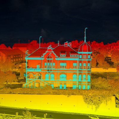
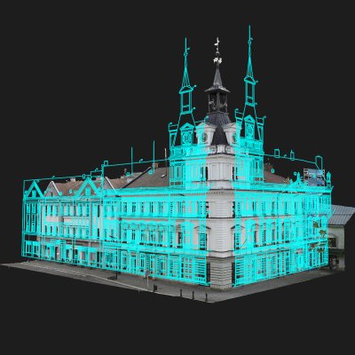
3D scanning has incomparable advantages over conventional geodetic surveying. 3D laser scanning is a non-selective and non-contact method. Its output, the so-called point cloud, describes in detail the surface of the object, including small details, unevenness, and curvature. When creating drawn documentation from a point cloud, we start from a digital copy of the object, not from several selected points as when measuring with a total station. Thus, much more information and context enter the drawing. The generalization (simplification) in the drawing is therefore much smaller.
For any building objects
Creating construction drawings based on point cloud from 3D scanning is suitable for all construction objects. For historic buildings, the scan will help record their atypicality, decoration and the ravages of time. We will effectively target hard-to-reach places such as attic trusses and underground spaces. For new buildings, 3D scanning will help create accurate as-built documentation and detect deviations in the project. We also recommend building information model (BIM) for modern building management.
Any outputs you need
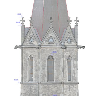
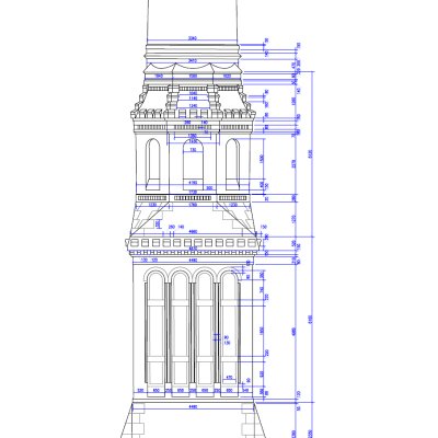
- floor plans and sections
- building passports
- orthophoto plans of facades
- thermal maps
- site layouts
- measuring floor area
- maps, contours, GIS
All outputs can be transformed into a selected coordinate system, e.g. the the World Geodetic System (WGS 84).
Výstupy, jaké potřebujete
- půdorysy, řezy, pohledy
- povinný pasport stavby pro stavební úřad
- podklady pro projektanty a stavební řízení
- ortofotoplány fasád
- průběh potrubí a izometrie potrubních tras
- průzkum poruch
- termální mapy
- situační výkresy
- výměry ploch
- mapy, vrstevnicové plány, GIS
Veškeré výstupy mohou být transformovány do zvoleného souřadnicového systému, nejčastěji do národního systému S-JTSK s výškovým systémem Bpv, využívaných v katastru nemovitostí.